Modern & Contemporary South Asian Art
Modern & Contemporary South Asian Art
Auction Closed
March 16, 05:19 PM GMT
Estimate
4,000 - 6,000 GBP
Lot Details
Description
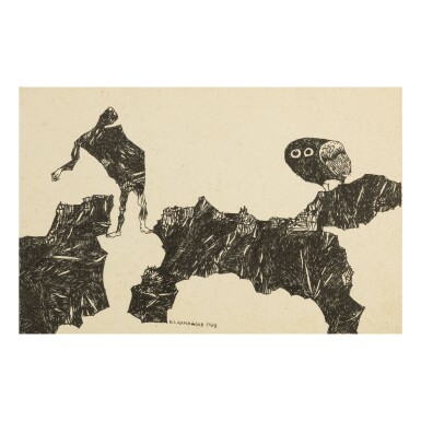
K. LAXMA GOUD
b. 1940
UNTITLED (MAN BETWEEN THE ROCKS)
Pen and ink on cardboard
Signed and dated 'K. LAXMA GOUD 1968' lower center. Bearing Aicon Gallery, New York label on reverse
6 ⅜ x 9 ¾ in. (16.1 x 24.7 cm.)
Executed in 1968
Private Collection of Chester & Davida Herwitz, Massachusetts
Acquired from the above by Aicon Contemporary in 2002
