Fine Books and Manuscripts
Fine Books and Manuscripts
Fine Books and Manuscripts
Fine Books and Manuscripts
2 July - 16 July 2021 • New York
•
Your local time • 17:00 PM GMT

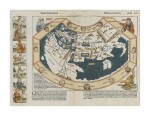
1 Schedel, Hartmann | The world before Columbus sailed

2 Montalboddo, Fracanzano da | The earliest accounts of travels to Asia and the New World and the first such printed in German

3 Waldseemüller, Martin | America appears on the map

4 Fries, Laurent | The first atlas map to use the word "America"

5 Munster, Sebastian | The famous Discovery-era world map

6 Thomaeus, Nicholas Leonicus | The 1555 Gryphius edition of De Varia Historia Libri Tres
![Strabo — Guilielmus Xylander [editor and translator] | Among the earliest and most important works on historical geography](https://dam.sothebys.com/dam/image/lot/115ef316-f067-4b89-a10a-d1339cffc5a8/primary/extra_small)
7 Strabo — Guilielmus Xylander [editor and translator] | Among the earliest and most important works on historical geography

8 Ortelius, Abraham | The first map of the Americas in a modern atlas

9 Lopes De Castanheda, Fernao | One of the first works in English on world exploration

10 Mercator, Michael | Evidence of early colonial efforts

11 Wytfliet, Cornelius | The first separate map of California

12 Linschoten, Jan Huygen van | An English Linschoten in contemporary vellum

13 Ortelius, Abraham | One of the most influential atlases ever published

14 Hondius, Jodocus | The height of Dutch cartography

15 Wytfliet, Cornelius | The first atlas of America

16 Speed, John | From the first atlas of the British Isles
![[Speed, John] | A charming map of Cambridge](https://dam.sothebys.com/dam/image/lot/2a50ab2f-295a-4b30-9619-9c0de4b373e8/primary/extra_small)
17 [Speed, John] | A charming map of Cambridge
![Mercator, Gerard [and Jodocus Hondius] | One of the most significant atlases in the history of cartography](https://dam.sothebys.com/dam/image/lot/699b58a5-2340-4c49-aafc-c3aba72aa40c/primary/extra_small)
18 Mercator, Gerard [and Jodocus Hondius] | One of the most significant atlases in the history of cartography

19 Blaeu, Willem | The most famous "carte-à-figures" map of the Americas

20 Blaeu, Willem | "The greatest and finest ever produced"

21 Jansson, Jan | The most important map in the adoption of California as an island

22 Sanson d'Abbeville, Nicolas | Establishing the shape of the West

23 Speed, John | Map of New England and New York, with original color and noble provenance

26 Valk, Gerard | A map of the Americas from the late Dutch period

27 Le Bruyn, Cornelius | First edition in French of this classic of Middle Eastern travel

28 Mortier, Pierre | First state of the first map of the Carolinas printed outside of England

31 Chatelain, Henri Abraham | One of the most decorative maps of North America

32 Johannes, Kip | A striking panorama of Westminster from the Thames

34 Seutter, Matthäus | The Island of California

35 Moll, Herman | The famed "Beaver Map"

36 Lotter, Tobias Conrad | The world accurately drawn in general outline

37 Mitchell, John | The primary political map in American history

38 Desnos, Louis Charles | Revival of interest in the Northwest Passage

39 Jefferys, Thomas, William Fuller, and William Gerard De Brahm | A rare set of sea charts of Amelia Island

41 Vaugondy, Robert de | The boundaries of the newly formed United States

42 Cook, Capt. James, and Captain James King | The famous accounts of Captain Cook's three voyages

44 Melish, John | Melish's War of 1812 atlas with contemporary military provenance

45 Petermann, Augustus | Barth's famed expedition to the Sudan
![[United States] — General Land Office | The opening of the West](https://dam.sothebys.com/dam/image/lot/9df06713-3027-4ba8-8a70-e9a8e8abfdcf/primary/extra_small)
46 [United States] — General Land Office | The opening of the West
![[Ship's Logs] — E[dmund] P[ercy] F[enwick] G[eorge] Grant | A logbook by an officer on board the HMS Achilles](https://dam.sothebys.com/dam/image/lot/b859e38f-f51d-4b34-824d-0e0b405f0418/primary/extra_small)
47 [Ship's Logs] — E[dmund] P[ercy] F[enwick] G[eorge] Grant | A logbook by an officer on board the HMS Achilles

48 Adams, John | Signed by Adams as president

49 Adams, John Quincy | John Quincy Adams celebrates the "last surviving Signer of the Great Charter of Mankind, the Declaration of Independence"

50 (American Revolution) | A rare transferware jug, celebrating the newly formed United States

53 Brown, John | A remarkable letter leading up to the events of the Bleeding Kansas crisis

54 Brown, John | A letter requesting arms prior to the Pottawatomie Creek Massacre

57 (Civil War) — Johan Anton Adolf Carlsson Warberg | A rare memoir by a Swedish officer

61 Declaration of Independence | Copied from the original Declaration of Independence in the Department of State

62 Declaration of Independence | Among the rarest broadside printings of the Declaration