Travel, Atlases, Maps & Natural History
Travel, Atlases, Maps & Natural History

SEA CHARTS | The English Pilot. Parts 1-4, 4 volumes, 1743-1740-1750-1742
Lot Closed
November 17, 01:57 PM GMT
Estimate
10,000 - 15,000 GBP
Lot Details
Description
SEA CHARTS--ENGLISH PILOT
The English Pilot [Parts 1-4]. London: for William Mount and Thomas Page, 1743-1740-1750-1742
4 volumes, folio (480 x 310mm.), engraved maps, contemporary sheep, the maps loose, most sheets soiled at foot, bindings defective, sold with all faults not subject to return
The set comprises:
Part I. Describing ... the Southern Navigation upon the coasts of England, Scotland, Ireland, Holland, Flanders, Spain, Portugal, to the streights mouth; with the coasts of Barbary, and off to the Canary, Madera, Cape de Verde and Western Islands. London: for William Mount and Thomas Page, 1743, 24 engraved charts
The Second Part. Describing ... the whole Northern Navigation .. the art of navigation ... the north coast of England and Scotland, with the islands of Orkney, Shetland, Lewis, Farre, Iceland &c. The sea coast of Flanders, Zealand, Holland, Germany, Denmark, Norway, Finland, Lapland, Russia, the islands of Vaigats, and Nova Zembla, as far as the Tartarian Sea. Also Greenland, Trinity Island, Cherry Island, Hope Island, &c. Sea coasts of Sweden, East Finland, Lyfland, Prussia, Pomerina &c. With all the islands belonging to the said countries in the Baltick sea. London: for William Mount and Thomas Page, 1740, 32 engraved charts
Part III. Describing the ... whole Mediterranean Sea. London: for W. and J. Mount and T. Page, 1750, 33 engraved charts
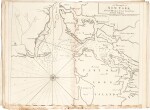
The Fourth Book. Describing the West-India Navigation, from Hudson’s-Bay to the River Amazones ... with all the islands therein as Jamaica, Cuba, Hispanola, Barbadoes, Antingua, Bermudos, Port-Rico, and the rest of the Caribee Bahama and Bahama islands. Also, a new description of Newfoundland, New England, New York, East and West New Jersey, Dellevar Bay, Virginia, Maryland, and Carolina &c. London for William Mount and Thomas Page, 1742, title printed in red and black, 27 engraved maps, many folding (see list below), without the map of the Gulf of Darien
List of maps in volume 4
Halley, A New and Correct Chart
A New Generall Chart for the West Indies, double-page
A General Chart of the Western Ocean, double-page
Sea Coast of New Found Land etc, double-page
Casco Bay, double-page
Coast of New-Found-Land, double-page, folding
Newfoundland from Bay of Bulls, double-page
Harbor Grace, recto
Bay Bulls, verso
Cattalina Harbor, recto
Port Bonavista, verso
Island of St Peter’s, in text
Coast of New England, double-page, folding
A draught of New York, double-page
Virginia, Maryland etc, double-page, folding
A draught of Virginia, double-page
Barbados, in text
Antegua, in text
Carolina, in text
Caribe Islands, double-page
Hispaniola, double-page, folding
Bay of Matanzas, single-page
Jamaica, double-page
Bahama Islands, double-page
Bermuda, in text
A draught of the Coast of Guiana, Surinam etc, double-page
Trading part of the West Indies, double-page, folding
