Travel, Atlases, Maps & Natural History
Travel, Atlases, Maps & Natural History


Lot Closed
November 15, 01:43 PM GMT
Estimate
800 - 1,200 GBP
Lot Details
Description
John Gibson
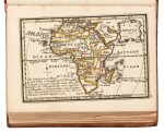
Atlas Minimus, or a new set of pocket maps, of the several Empires, Kingdoms and States of the known World, with historical extracts relative to each. London: J. Newbery, 1758
16mo (112 x 80mm.), plain engraved allegorical frontispiece, title, preface, index leaf with errata, 52 engraved coloured maps with labels and text, engraved publisher's advertisement leaf at end, contemporary calf, spine gilt-ruled with raised bands in five compartments, some offsetting, smoke damage to outer margins of maps 22 and 36-40 (damage to map 36 not affecting illustration, the others with some loss of illustrations), extremities slightly rubbed
The maps of this rare miniature atlas "were drawn and engraved by John Gibson, a mid-eighteenth century engraver who is perhaps best known for his four-sheet map of North America following the Treaty of Paris, 1763" (Shirley). This copy is "revis'd, corrected and improv'd" (title page) by Emanuel Bowen, the celebrated map engraver who served as Royal Mapmaker to both King George II of Britain and King Louis XV of France. A printed note at the back promises a future volume of the Counties of England and Wales produced, also by Gibson, which was first published in 1759 by Francis Newbery. The miniaturist maps are highly detailed and comprehensive, featuring brief historical notes.
LITERATURE:
ESTC T163454
You May Also Like